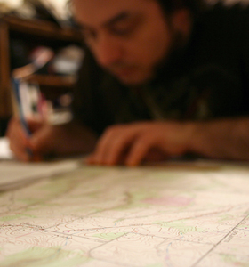
A great episode of This American Life on Mapping. This dates all the way back to 1998!

thisamericanlife.org
Link: http://www.thisamericanlife.org/radio-archives/episode/110/mapping
A great episode of This American Life on Mapping. This dates all the way back to 1998!
thisamericanlife.org
Link: http://www.thisamericanlife.org/radio-archives/episode/110/mapping
Two men in Edinburgh UK noticed a Google Street View car coming up their street and quickly staged a fake murder scene. You can see for yourself by Googling “73 Giles Street, Edinburgh, UK”

Google.com
It’s that time again, April Fools’ Day or as I like to call it: Christmas for the Internet!. This year Google actually created a game with their April Fools’ joke which took place solely on their mobile platforms. It all started with the job announcement of Pokemon Master.
We all know Stamen Maps and their amazing Watercolor Map powered by Open Street Map but it appears they just got better. Map Stack allows you to take your favorite Stamen maps and stack them, basically you can create mash-ups of all of their maps using up to 5 Layers.

Toner and Water Color (with colors inverted) Map Stack of Portland, OR using an HSL-Color Blend
http://mapstack.stamen.com/
There were some incredible maps from this year’s FOSS4G (Free and Open Source Software for Geospatial) map gallery. Here are a few of my favorites:

nychenge.com
Wired Magazine and the accompanying website have long been one of my favorite sources for geek news. Leave it to Wired to go and start one of my favorite map blogs: Map Lab. The blog is relatively new, July of 2013, but it already offers stories on some of the best maps I’ve seen on the web. Go check it out!
Link to Map Lab: http://www.wired.com/wiredscience/maplab/

Ever wondered how to make maps? Now with Coursera, in conjunction with Penn State’s Geography Department, you CAN!! If you haven’t heard of Coursera, it is a Massive Online Open Course or MOOC. This is a free online class from an accredited college that can be taken for fun or for credit with a small fee.
Public Laboratory has done it again with their newest kickstarter, an affordable infrared camera! This in combination with their balloon mapping kit could allow anyone to do remote sensing. There are only three levels but all of them net you the end product; an infrared camera! For only $10 they will send you a DIY kit, for $35 an infrared webcam, and for $95 you get the whole camera. Check it out!
I just stumbled upon this real neat website called Old Maps Online. It’s a repository of old paper maps all organized in a really nifty web interface.

Old Maps Online’s Web Interface
Spending three days at the NACIS 2012 conference was an amazing experience. I went to some incredible sessions but a cartographic conference is really all about the maps. Here are some of my favorites from the maps gallery.

Portland Crossings by Nick Martinelli