Portfolio

Wall Map for Lake Oswego Fire Dept
Summer 2013: This was a series of posters created for the Lake Oswego Fire Department. They required wall maps of the Willamette, Clackamas, and Tualatin rivers along with all the
Read more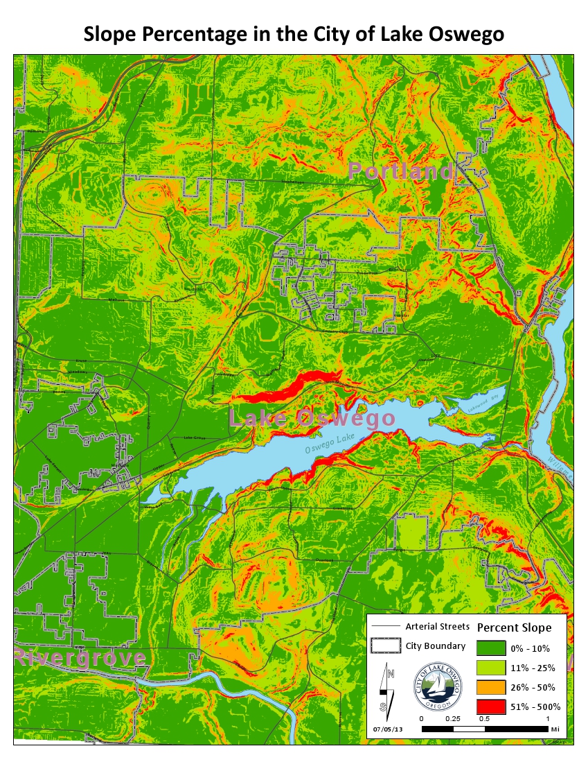
Lake Oswego Slope Percentage
Summer 2013: This map was created by request from a graduate student for a project they were working on. I used the DEM obtained from metro to calculate the slope.
Read more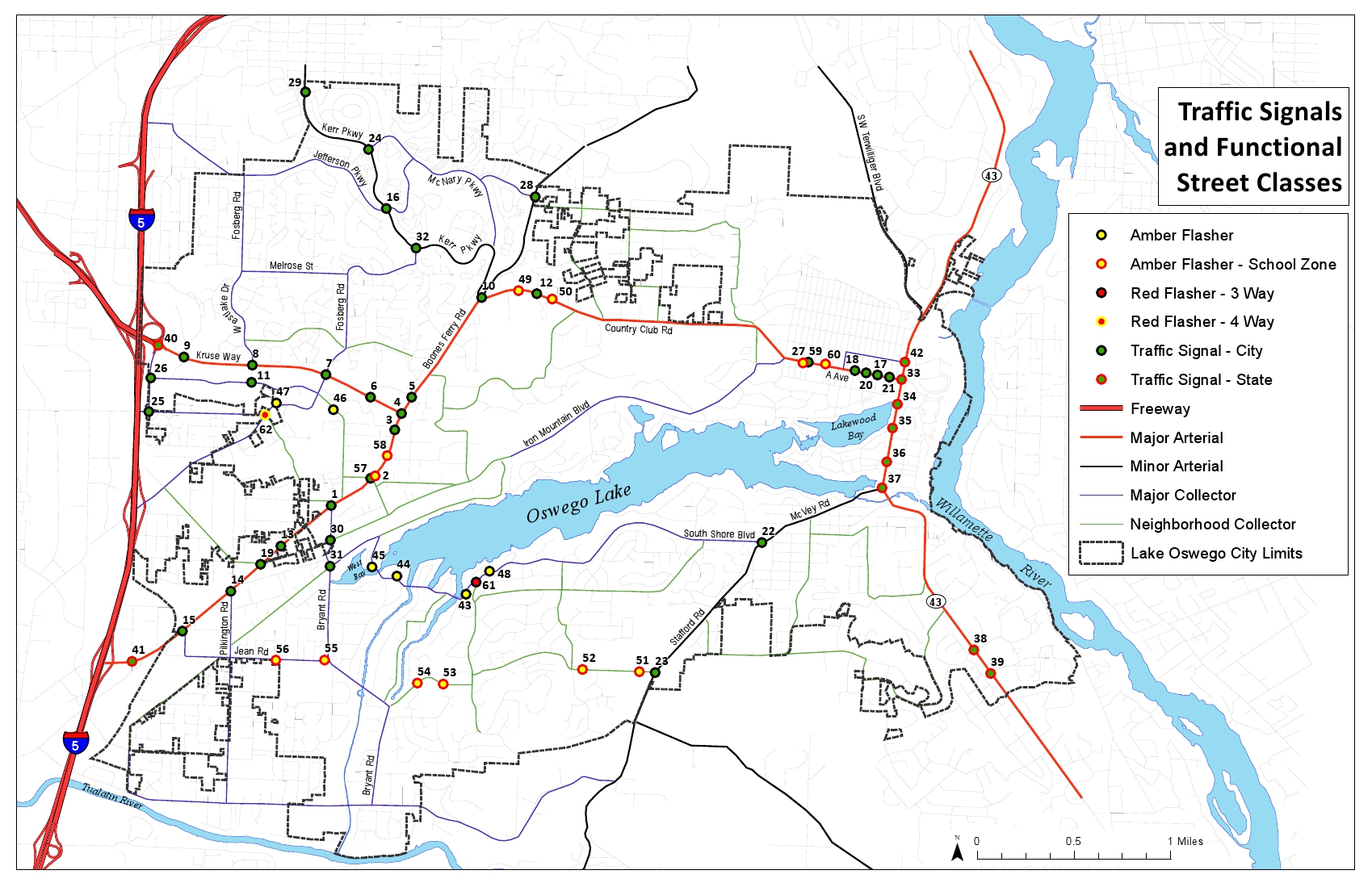
Traffic Signals in Lake Oswego
Winter 2013: Created a map classifying different street light types and the different street classes in Lake Oswego. This map was used internally by the engineering department.
Read more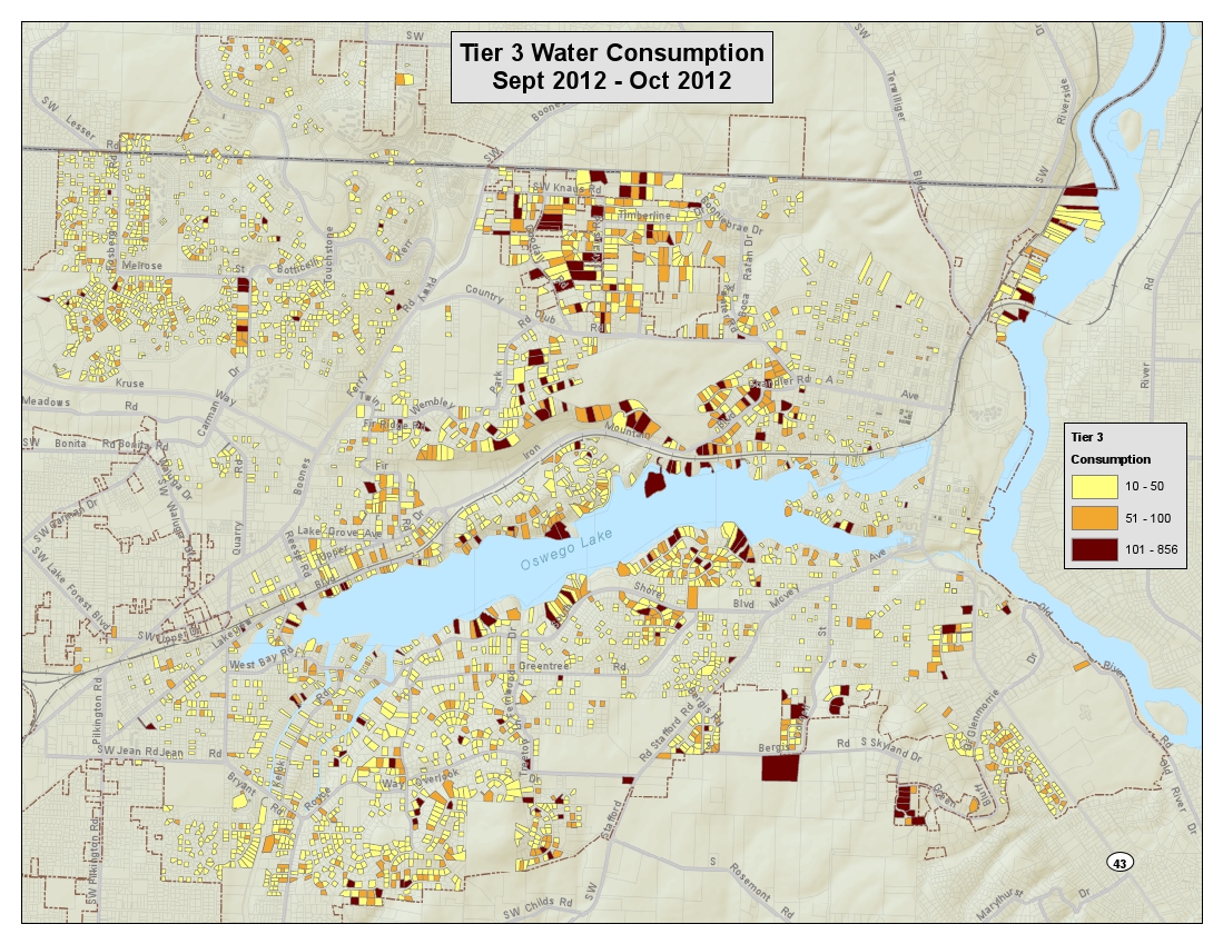
Water Consumption in Lake Oswego
Winter 2012: This was a map created using the data of all the water consumption in the city. This data was organized into the properties with the highest water consumption
Read more