There were some incredible maps from this year’s FOSS4G (Free and Open Source Software for Geospatial) map gallery. Here are a few of my favorites:
This map shows the sunsets in Manhattan as seen through the buildings, more specifically: “Twice a year the sun aligns with the midtown grid in NYC, days we call, Manhattanhenge.” This interactive map shows the viewshed of these sunsets brilliantly!
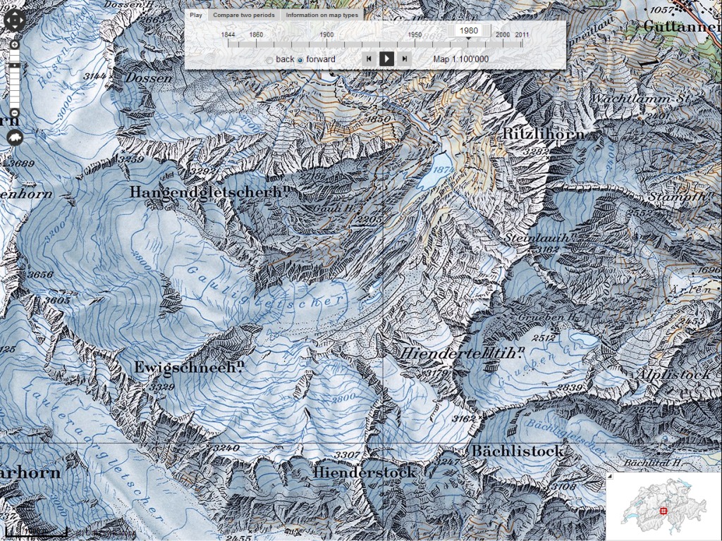
This web map really demonstrates the beauty of relief shading Swiss topographic maps and how they have changed over time.
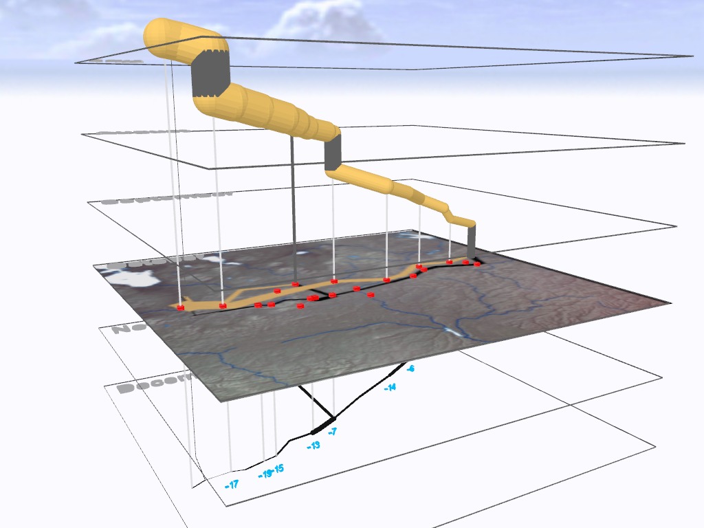
http://carto.maps.arcgis.com/apps/CEWebViewer/viewer.html?3dWebScene=2b48caaabd0e44028724c5f109f3de97
While not actually open source, this map uses 3D imagery to show Napoleon’s march on Moscow. This is the first interactive map I’ve seen using ArcGIS’s City Engine Web Viewer and I can’t wait to see more.
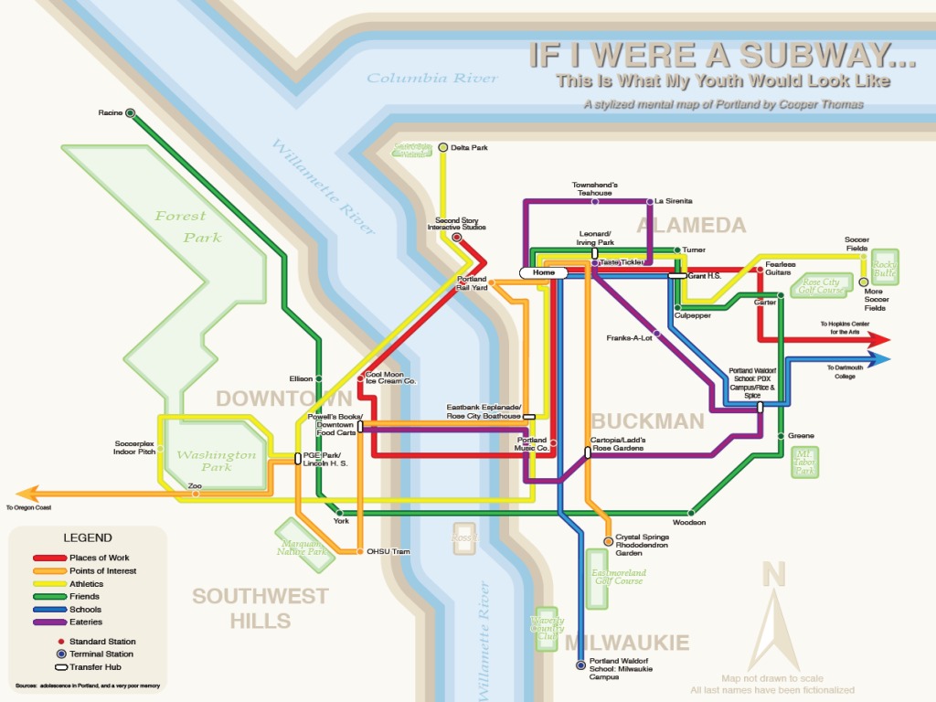
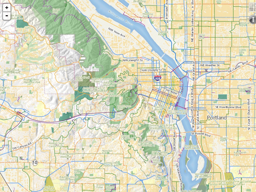
There were also two maps from Portland:
This maps the author’s travelling patterns in the style of the MAX rail system, I’m pretty sure my version would rarely cross the river over to the westside (except for school).
The level of detail in this web map is really quite beautiful once you zoom in a bit. The trees never cease to amaze me.
There are 76 maps in total, truthfully I haven’t even had a chance to look at them all, so be sure to head over to the map gallery to check them all out. As of when this post was written they were still taking votes for the “People’s Map” contest, so go and vote for your favorite.
Link to FOSS4G Map Gallery: http://2013.foss4g.org/conf/gallery/
Link to NYC Henge: http://nychenge.com/
Link to Swiss Topo Journey Through Time: http://s.geo.admin.ch/3577768db
Link to Napoleon’s March on Moscow Interactive Space-Time Cube: http://carto.maps.arcgis.com/apps/CEWebViewer/viewer.html?3dWebScene=2b48caaabd0e44028724c5f109f3de97
Link to If I Were a Subway… : http://carto.maps.arcgis.com/apps/CEWebViewer/viewer.html?3dWebScene=2b48caaabd0e44028724c5f109f3de97
Link to Oregon Metro: http://gis.oregonmetro.gov/metromap/


Leave a Reply