Spring 2003: This was a simple map using the available topographic map to show the study area. This was my senior project in Environmental Studies studying logging gaps and exotic species in an area north of Santa Cruz. These were all paper copies so the quality leaves something to be desired.
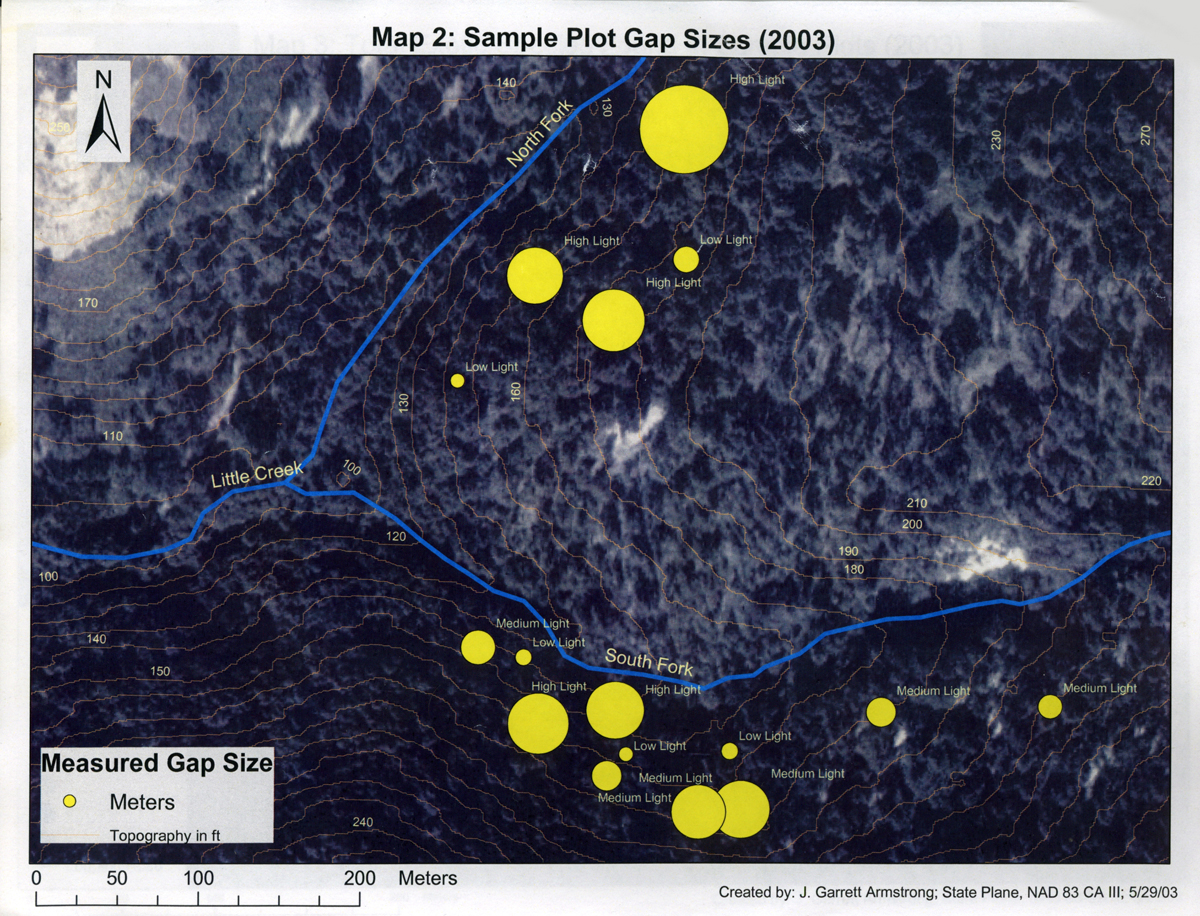
This map shows the size of the gaps in the canopy and the amount of light measured in the plots. Topography was included to show the steepness of the plots.
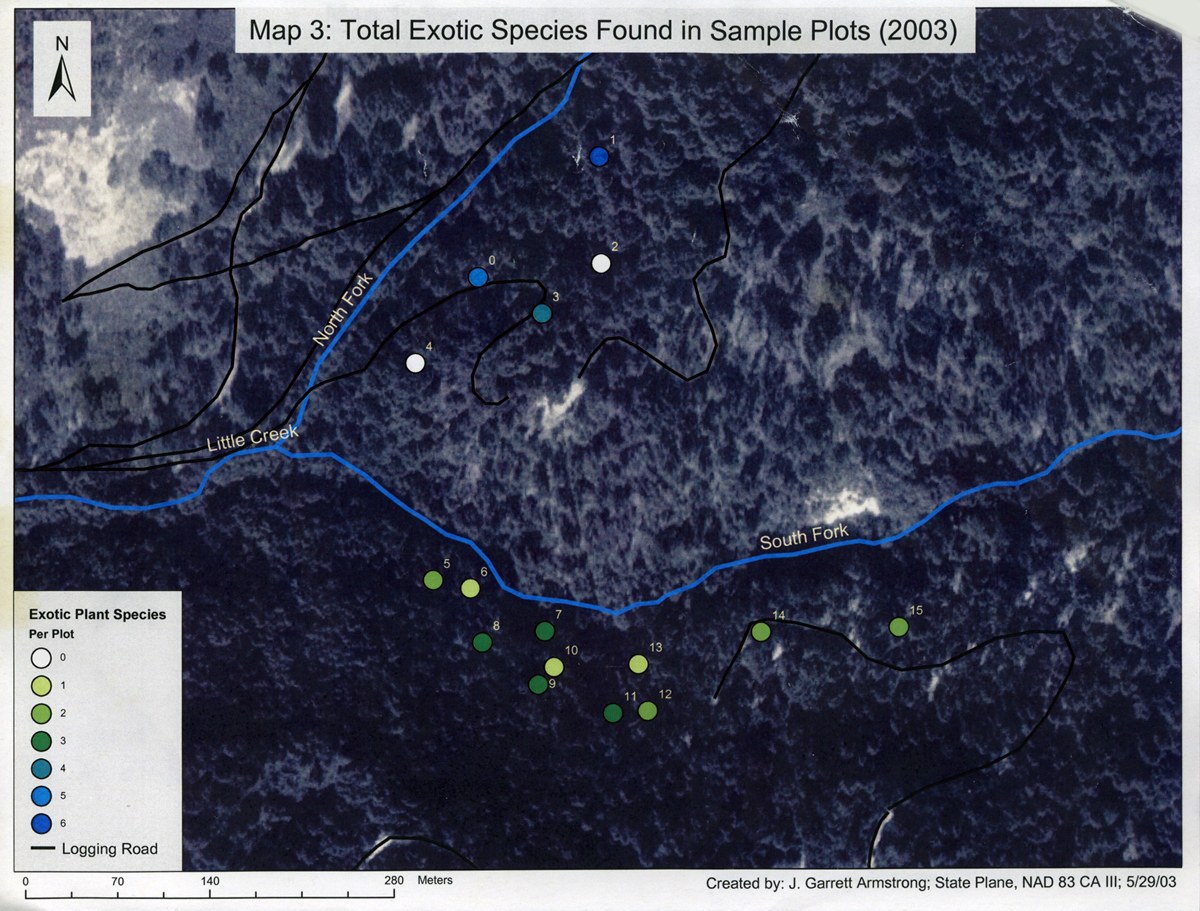
This map shows the number of exotic plants per plot with the corresponding plot numbers. The logging roads were included for context.
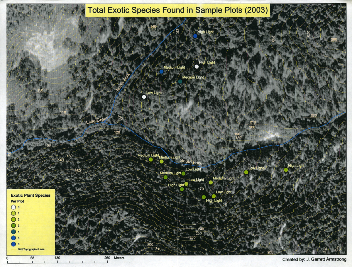
This was the final map that showed both the amount of light per plot and the amount of exotic plant species.


